Start at the site of the old Piccotts End mill. There has been a mill on this site for a very long time, possibly even before the Domesday Book. It had ceased operation by the time I knew it and the large mill pond was gone The premises were in use as an animal feed outlet with most customers entering the site from the Leighton Buzzard road. Much of the product was stored in two large barn structures of corrugated iron, mercifully shielded by trees.
After the site was sold the developers were given permission to turn it into flats and houses providing the face of the mill was preserved as both it and the mill house were listed. The mill was mysteriously destroyed by fire and was almost immediately de-listed. Then the developers sold the site to Barratts who razed the mill and built the block of flats on the site. If you look at pictures of the mill you will see that the flats have been built one storey taller than the original mill.
Cross the road to a very narrow path and turn right. This boundary juts right out because this is where the smithy stood before the house, Greenbanks, was built in the 1930s. As the old maps show, the smithy was very close to the road. Walk along the footpath until you are opposite the stile, this is a comparatively new right of way. The gap filled by the fence is unusually wide; there were several cottages where the field is now and one of them was lived in by a carter and possibly wheelwright so the gap had to be big enough to drive a cart through. These cottages have disappeared by the 1925 map. The old right of way is a little further along near the entrance drive to Piccotts End Farm. If you cross the road you can see how well the now blocked-off entrance to the field crossing was constructed This footpath is shown on the 1878, 1898 and the 1925 maps so the closure is comparatively recent. An old aerial photograph shows the right of way still open.
Continue through the hamlet looking at the right hand side. 117, Plccotts End Farm, was originally two buildings. It contains several wall paintings, mostly floral with texts. Next we come to 109, Gadespring House (17th C) which appears to have been a farm at one time. Looking carefully it would appear that the original entrance was in what is now the right hand side of the building and that a new and later facade was built on to the side facing the road. The numbering suggests several missing buildings. Severat cottages, 107 to 98, are listed 17th and 18th Century and 101 has a Phoenix plaque on the wall. Next is the Boars Head public house, which has been in continuous use as a public house for at least a century. The long wall next to the pub is a site which appears to have been enclosed by squatters; the next house is Blue Gate, fairly modern. The last building on this side is The Marchmont; its history is detailed in “Piccotts End a noteworthy End of Hertfordshire.” One note of interest is that the gateposts are listed separately to the house, affording them greater protection .The house was the home of the Earl of Marchmont who died in 1794 at the age of 86. In the 1843 census it was owned and occupied by the Dowager Lady Cooper.
Opposite the Marchmont is the site of Marchmont Farm, which, in the 1970s and probably before, was a turkey farm but has long since been developed for housing and workshops. Piccotts End School was sited part way up Piccotts End Lane, on the right hand side near where the gate now blocks vehicular trafftc. It was established in 1877, closed in 1939 and demolished soon after. The lane was once open to traffic and took one up to Henry Wells Square before the link road was built. It is possible that the corner cottage on the other side of the lane, Decapo 42, was a public house or ale house but the cottage at the other end of the row, No 60, certainly was a public house. It stands on the corner of a short right of way leading through to Piccotts End
Lane, with Victoria Cottage No 3 PE Lane at the end.
On the other corner is No 62, a white house, and then after a long gap No 92, Wall Cottage, probably dating back to the 19th Century. This is followed by what were a row of small cottages now condensed `into three dwellings, numbers 94, 96 and 104, all built in the 17th Century. Further down the road we come to the church. Built in 1907 and listed, it was de-consecrated in the 1960s and is now a house. To the right hand side of the church is a short lane which at one time went right up the hill to Highfield as did Piccotts End Land. Next to Church House are several cottages, Nos 114, 116 and 118, one of which was at one time the Post Office. Next comes Old Infirmary Yard and the row of cottages Nos 130 to 136, all listed 15th C. The cottage on the right-hand end of this row houses medieval wall.paintings, the Georgian house is listed l9th C, and the cottage next to it was a small antiques shop which was open whenever the wall paintings cottage was open.
Also on display was a collection of old chemists shop equipment and memorabilia of Sir Astley Paston Cooper. Visitors were told the story of the
famous surgeon to King George the 4th. Eager to show his prowess he invited some friends to dinner, serving them a leg of mutton. After the meal the dining room door opened and a live three- legged sheep was brought in – a triumph of the surgeon’s art.
The next house, sideways on, listed 19th Century, is notorious as the former home of a man who, unable self the house he had built in the back garden, kidnapped the wife of a wealthy man from Markyate and held her to ransom for a million pounds. He held her in a room above his wife’s shop in the Old Town High Street from where she was rescued by a milkman.
Next 142 to 146, listed 19th Century. This is the old Windmill pub and cottages, which have been incorporated. I have met people who remember it being open but don’t know when it closed. The three cottages .which are the last of the old buildings comprise 148 and 150 listed between l7O2 and 1714 and the Old Bakery, which was added on in the late 1840s to tie the barn at the rear of the houses to the front. At one time the whole of these premises were owned by a baker and had been home to many other businesses prior to that. These houses changed from Nos 76 and 77 to their present numbers between 1948 and 1954.
 The Marchmont Arms, once the home of Lord Marchmont, has been transformed into a modern, stylish, gastro-pub. Built in the 18th Century by Lord Marchmont, the building was a private residence for over two centuries before being converted.
 The Boars Head ended a century as the village pub in 2010 and is now a private residence marked by a blue plaque and an eponymous bus stop.
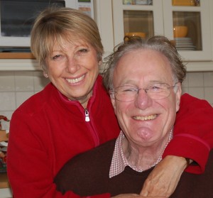
  The village also has strong political connections, most recently with Lord Corbett of Castlevale, the former Labour MP Robin Corbett who lived in Piccotts End from 1966 until his death in 2012. His wife Lady Val Corbett is one of the village’s longest standing residents.
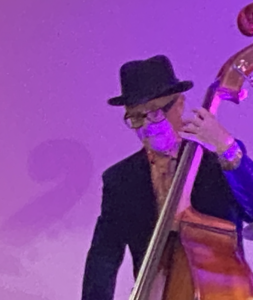
  Next to Paul lives another outstanding musician, Kelvin Cantlon. Kelvin is a founder-member of the Budapest Cafe Orchestra in which he plays double bass. The BCO travel the world with their infectious brand of Balkans-influenced music.
  Piccotts End is home to several leading names in the media. Among them is Radio 3 presenter Penny Gore. After seven years of having to be up before dawn for the journey to Broadcasting House and her early morning programme of classical music, Penny is now enjoying a lie-in. From April 2007 she has been presenting The Afternoon Concert – a move which has not been without some controversy. Some of her male fans have complained that they miss her velvet voice early in the morning – ‘so much more soothing than all that shouting on Radio 4’ said one!


 Piccotts End is renowned for its mediaeval wall paintings. They date back to the late 15th century but were only discovered in 1953. They are believed to have been painted by pilgrims staying in a row of cottages while on their way to The College of Bonhommes monastery at Ashridge. They were later covered up to protect them from destruction during the Reformation.